A dedicated mobile application can bring GPS tracking closer to employees, customers, and field teams through each organization's own experience. This update introduced a GPS tracking application generator for Android and iOS in ALTAGAMA GPS that prepares customizable source code for review, compilation, and publication by a team with mobile development knowledge.
The generator offers four cumulative configurations: basic device viewing, phone tracking with offline commands, compatible native maps, and mobile notifications. It also uses basic elements configured in the account, such as the access address, icons, and logos, to create a starting point aligned with the organization.
What ALTAGAMA GPS generates and what the customer must complete
ALTAGAMA GPS generates a source project for the two main mobile platforms. The project is prepared as a technical foundation, but it is not an automatically published application. Before distribution, a responsible team must review configuration, complete credentials and permissions, compile, test, sign, and submit the application through the appropriate publication channels.
This approach provides flexibility to businesses with technical capability or a development partner. The customer remains responsible for validating operation, security, legal text, privacy, user experience, and compliance with the current policies of each store.
Initial customization with account identity
The generated code uses basic customization based on the access address, icons, and logos configured for the account. This helps start the project with visual and connection elements already associated with the organization.
Basic customization does not replace a complete product design process. If a business requires additional workflows, extensive interface changes, its own integrations, or specific policies, its technical team must assess and maintain them on top of the generated project.
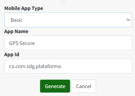
Basic application for viewing devices
The first configuration lets authorized users view devices associated with their account from the application. It is suitable when the main goal is providing mobile access to tracking without adding phone-specific capabilities.
A customer can use it so supervisors review vehicles in the field, owners check authorized assets, or security personnel retain visibility while traveling. What each user sees continues to depend on permissions and information available in ALTAGAMA GPS.
Phone tracking and offline commands
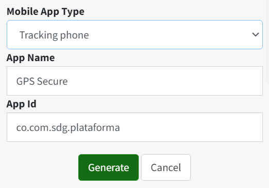
The second configuration includes device viewing and adds the ability to use the current phone as an authorized location source. It also includes compatible offline commands, which are useful when an action can be sent through an alternative channel and a data connection is unavailable.
Phone tracking requires consent, location permissions, and appropriate background and battery configuration. Continuity depends on the operating system, coverage, phone accuracy, and user restrictions. Commands depend on tracker capability, available channel, and correct configuration.
Compatible native maps inside the application
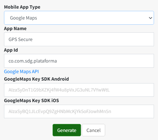
The third configuration combines the earlier functions and adds a compatible native map service inside the application. This provides more natural mobile interaction for zooming, moving around, and reviewing device positions.
The map experience supports tasks such as locating a vehicle, following a visit, or reviewing the context of an alert. Accuracy does not come from the map itself; it depends on received positions, tracker installation, coverage, and signal quality.
Notifications on the phone
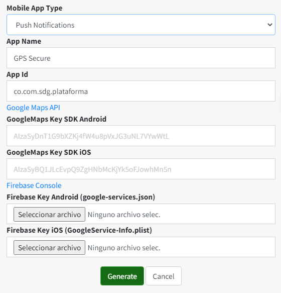
The fourth configuration adds mobile notification reception to the previous capabilities. A properly configured application can inform the user about events associated with the operation, subject to enabled permissions, rules, and notification services.
To use this capability, the publishing team must configure the required credentials, request user authorization, and test delivery in different phone states. Notifications can reduce response time, but they should not be the only channel for critical situations because delivery can be affected by network, battery, or system restrictions.
How to choose the right configuration
- Basic: for organizations that need to view devices from their own application.
- Phone tracking: for authorized cases where the mobile phone will also report location and use compatible commands.
- Native maps: for a more integrated mapping experience on the phone.
- Notifications: for informing users about events in addition to the previous capabilities.
Because configurations are cumulative, organizations should choose the minimum option that covers the actual need. Fewer permissions and components usually simplify testing, support, and privacy explanations for users.
Recommended process from generation to publication
- Define the audience, use cases, and required functional configuration.
- Verify the access address, icons, and logos configured in ALTAGAMA GPS.
- Generate the project for the platforms the organization will support.
- Provide the code to a professional experienced in mobile applications.
- Configure identifiers, signing, permissions, and required external services.
- Review security, consent, data processing, and privacy policies.
- Compile and test sign-in, devices, maps, tracking, commands, and notifications according to the selected scope.
- Publish through the organization's accounts and complete each store's review process.
- Maintain the project when ALTAGAMA GPS, operating systems, or distribution policies change.
Real-world applications for businesses and tracking services
- Private fleets: provide supervisors with an app focused on authorized vehicles.
- Security and assets: simplify mobile location reviews during routes or inspections.
- Customer services: deliver a mobile experience associated with the company's identity.
- Field teams: combine device viewing, maps, and notifications during operations.
- Consented tracking: use phones as location devices in authorized and transparent situations.
Privacy, security, and consent
An application that views devices, tracks a phone, or sends notifications handles sensitive information. The organization should apply least-privilege access, protect credentials, clearly explain which data is collected, obtain necessary authorization, and provide ways to disable tracking when appropriate.
It should also review system permissions, data retention, user support, lost phones, and account removal. The generated application inherits the configured scope, but responsibility for distribution and use remains with the organization that compiles and publishes it.
Generated code as a technical starting point
The source code is provided as a foundation without a guarantee that it alone covers every commercial, legal, or technical requirement of an organization. It should be used with mobile development knowledge and tested before any deployment.
Operating systems and stores change over time. An application compiled on a particular date may later require adjustments for new versions, privacy rules, certificates, permissions, or phone capabilities.
Functional summary for customers and integrators
This update added a mobile project generator for Android and iOS with basic account-based customization and four cumulative scopes: device viewing, authorized phone tracking with offline commands, compatible native maps, and notifications. The result requires technical review, configuration, compilation, signing, testing, publication, and maintenance. Visible functions depend on permissions, plan, tracker data, and the application's final configuration.
Explore ALTAGAMA GPS plans and features to assess how a custom mobile experience can support your GPS tracking service.